A new online tool available from the NJTPA will give municipalities and other agencies access to detailed travel data for hundreds of locations, helping them conduct feasibility studies for projects to improve safety and address traffic problems.
The
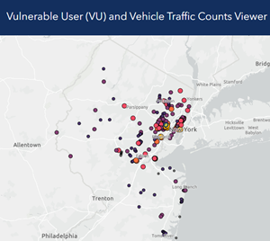
Vulnerable User (VU) and Vehicle Traffic Counts Viewer is an online database of traffic counts collected by the NJTPA available for public access.
Aimee Jefferson, Principal Planner, Safety Programs in Local Project Development, at the NJTPA, provided a demonstration of the new tool during the Regional Transportation Advisory Committee’s Feb. 13 meeting.
The focus is on vulnerable users, like pedestrians, cyclists, and micromobility users, though many vehicle-focused counts are also available, according to Jefferson. The viewer primarily has been used to conduct Level Of Service (LOS) evaluations for Local Safety Programs and other highway safety and manual analysis.
Municipalities and other agencies can use it where high counts would help determine whether facilities are feasible, such as:
- Road diet feasibility studies
- Traffic signal warrant analysis
- Bike lanes and improved crosswalks
The database is one of the recommendations from a two-year effort by NJTPA in 2020 to collect traffic counts with a focus on collecting pedestrian, bicycle, and micromobility counts, as well as vehicular counts, and developing count standards and recommendations.
In New Jersey, the
Delaware Valley Regional Planning Commission (DVRPC) and Department of Transportation (DOT) also publish traffic count data, Jefferson said. DVRPC only collects counts for its region and DOT's online database only has vehicular counts.
The VU tool currently has more than 400 locations and three data types with bicycle, pedestrian, micromobility and vehicular volumes. Data includes counts collected during NJTPA projects as well as any counts subregional partners have shared with NJTPA. “As count data becomes more robust, more detailed modeling and forecasting of bike, pedestrian, and micromobility volumes may also be available and possible,” she said. New locations are added on a rolling basis.
A table function allows users to export datasets and a glossary breaks down technical language and provides sources of the data and potential use cases.