


A new interactive online tool provides a bird’s eye view of routes that are optimal for expanded walking and biking and can be integrated with the existing active transportation network around Northern New Jersey.
Keith Hamas, Principal Planner, Safety Planning, at the NJTPA presented an overview of the Active Transportation Plan Data Viewer to the Regional Transportation Advisory Committee during its February 10 meeting.
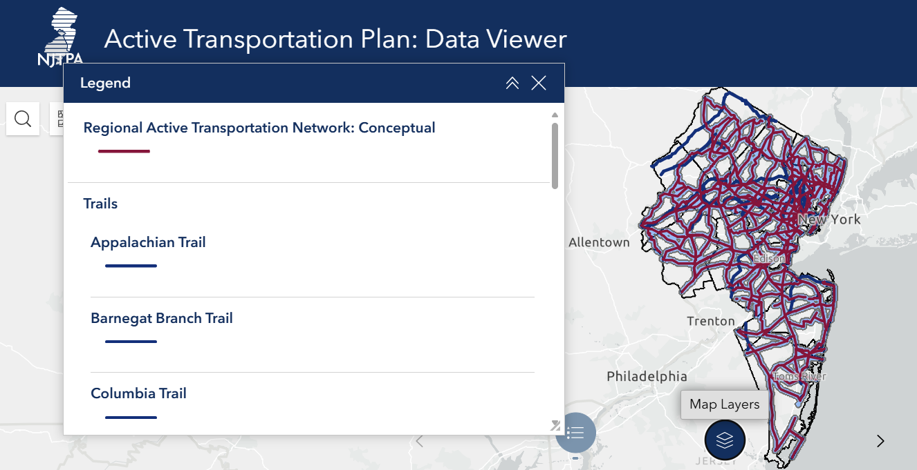
The interactive online tool builds on the NJTPA’s Active Transportation Plan completed in 2023. The plan establishes a common framework for counties, municipalities, and the state to create active transportation routes, Hamas said.
The online network is one piece of the plan and should be viewed alongside the strategy guide, case studies, and final plan document which offer best practices for implementation, Hamas said. The online tool is not a bike map but rather “aspirational” for options to expand walking and biking networks.
While the tool identifies potential routes, all require further study. The tool displays a half-mile buffer along routes to encompass potentially suitable alternatives.
The plan uses data layers for trip potential analysis, a heat map that displays where people are likely to walk and bike based on demographics, intersection density, land use mix, and other analyses that inform regional connectivity.
Other layers in the online tool feature transit facilities, highway interchanges, greenways, and scenic byways. For each layer, users can toggle on or off and adjust the layer order, optimizing what they’re looking for.
Local implementers might want to look at related NJTPA programs where this data might be applicable, Hamas said, such as Complete Streets Technical Assistance, demonstration projects, trails programs, and Local Safety Action Programs.
The Active Transportation Plan Data Viewer can be accessed here.