

The NJTPA region is the platform for the distribution of goods to one of the largest consumer markets on earth. This encompasses the New York-New Jersey-Connecticut metropolitan area and much of the mid-Atlantic and New England states. The region is also a leading US international gateway with the largest port on the Atlantic Coast and one of the largest air cargo operations in the US.
The NJTPA supports freight in the region by:
- Identifying and addressing regional and local freight needs in coordination with public and private sector partners
- Developing and disseminating freight data, forecasts, and planning tools
- Conducting freight planning studies
- Managing the Freight Concept Development Program to advance local and regional freight initiatives
- Hosting the Freight Initiatives Committee to serve as a regional forum for freight dialogue and education
Freight at a Glance
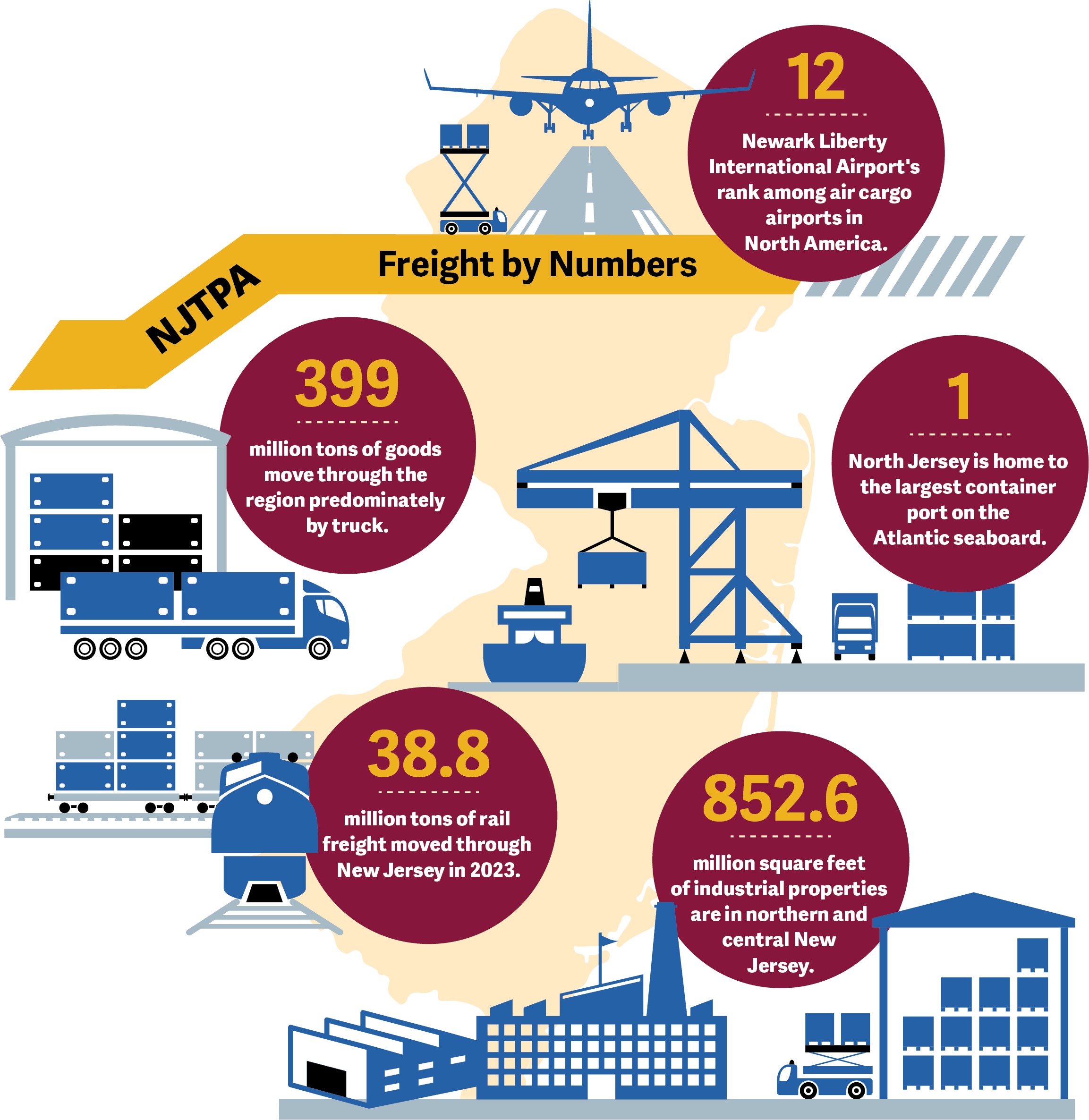
The region’s freight system includes:
- Port: Northern New Jersey is the home of the largest container port on the Atlantic seaboard. The Port handled 8.9 million TEUs in 2025. The rail lifts at the Port totaled 719,000 in 2025. The Port also handled 365,000 vehicles, 3.1 million metric tons of bulk cargo, and 846,000 cruise passengers during 2025. Source: Port Authority of New York and New Jersey
- Rail: Northern New Jersey is served by two Class I railroads—CSX and Norfolk Southern, a regional railroad (the New York, Susquehanna & Western), and several short line railroads. This region also includes the Conrail Shared Assets Area and extensive on- and near-dock rail operations that serve the Port. In 2023, New Jersey had 17.2 million tons of rail freight originating in the State and 21.6 million tons terminating in the State. Source: The Association of American Railroads.
- Air: During 2025, Newark Liberty International Airport handled just over 679,000 tons of air cargo. In 2025, the three leading airlines in terms of cargo volume were Federal Express, UPS and United. In 2025, the Airport was ranked as the 12th largest air cargo airport in North America and 50th in the World. Sources: Port Authority of NY and NJ, Airports Council International
- Trucking: Trucking moves the most freight in the NJTPA region. Approximately 70 percent of the total 399 million tons of goods moved in the region were handled by trucks. Source: NJTPA 2050 Freight Industry Level Forecasts Update.
- Industrial Properties: As of the second quarter of 2026, northern and central New Jersey had 852.6 million square feet of industrial properties, one of the leading concentrations in North America. About 1.9 million square feet of new construction started during the quarter. Vacancies decreased during the quarter and are now at 7.6%. Source: CBRE
Data, Forecasts, and Planning Tools
Freight Activity Locator
The Freight Activity Locator is NJTPA’s ArcGIS-based freight data hub for North Jersey, providing interactive maps, dashboards, and datasets on freight facilities, corridors, truck parking, and commodity, and growth forecasts. It includes themed pages for the regional freight systems, developments opportunities, truck parking, and freight profiles. The freight profiles provide a 2050 freight industry level forecasts by region and by commodity type, including data on highway utilization, e-commerce, freight facilities, tonnage and more. The data provided in the Freight Activity Locator may be used to:
- Screen corridors and sites for freight significance
- Justify grants and investments with mapped evidence of freight activity and needs
- Understand how local industrial/warehouse districts fit into the regional system
- Identify truck parking constraints and high-impact freight opportunity areas
Goods Movement Strategies for Communities
The Goods Movement Community Engagement Tool is NJTPA’s interactive web resource for helping communities understand and learn how to address the impacts of goods movement by truck on local streets and neighborhoods. It explains the basics of freight and deliveries, illustrates how truck routes, land use, and curb activity affect quality of life, and offers practical strategies communities can use to respond to concerns about noise, safety, congestion, emissions, and operations. Freight research and strategies are constantly evolving; this tool is for information purposes only.
Freight Concept Development Program
The Freight Concept Development Program (FCDP) advances regional and local freight initiatives identified through planning studies conducted by the NJTPA, its planning partners and its subregions. Two studies are underway:
- Southern Middlesex County North-South Truck Corridor Project in Cranbury, Monroe, and South Brunswick, Middlesex County
- East Hanover Avenue Bridge Catenary Rail Clearance Project, in Morris Plains, Morris Township, and Parsippany, Morris County.
Projects and Studies
Current and recently completed NJTPA freight planning initiatives are listed below. Past initiatives can be found on the NJTPA Studies page: