

A new strategic plan for the Berkeley Heights train station area lays out a vision for a safer, more walkable and better-connected downtown, with improvements ranging from enhanced pedestrian crossings and more organized parking to new public spaces and streetscape improvements.
The Berkeley Heights Transit Hub Strategic Plan was developed through the NJTPA Transit Hub Planning Program in partnership with the American Planning Association’s volunteer planning program. The plan was presented to the NJTPA’s Joint Project Prioritization and Planning and Economic Development during its October 17 meeting.
Mike DiGeronimo, principal and founder of In-TOWN Design Studio, led a 15-member team of planners, architects and landscape architects that worked with the township for approximately 18 months to develop the plan.
Jeff Vernick, NJTPA Manager of Performance Analysis and Planning and coordinator of the Transit Hub Planning Program, explained that the program helps communities strengthen the connections between transit and the neighborhoods, businesses and public spaces surrounding it.
Many downtowns were originally organized around train stations, bus stops and trolley centers, which served as hubs of commerce and everyday activity. As communities became more automobile-oriented, those connections weakened. The Transit Hub Planning Program seeks to reconnect active transit systems with the fabric of surrounding communities while creating walkable, vibrant places that serve residents, visitors and other users.
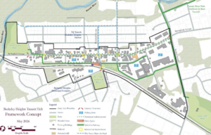
The Berkeley Heights study examined an area within roughly a half mile, or a 10-minute walk, of the NJ TRANSIT station on the Gladstone Branch. The area includes Springfield Avenue, the township’s commercial core, as well as the municipal building, library, downtown businesses, nearby parks, and public uses.
Community input shapes vision
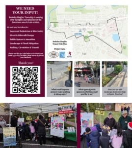
Community engagement was central to the planning process. Outreach began with in-person activities at a street fair in partnership with the township’s Complete Streets Committee, followed by an online survey conducted over approximately two months and received more than 500 responses.
The initial survey asked participants about transportation, public spaces and potential land-use changes and included images illustrating possible Complete Streets treatments and other improvements. A separate survey conducted by the nearby middle school helped the team incorporate perspectives from younger community members.
Feedback showed strong interest in improving walkability and pedestrian safety, creating a stronger sense of place, organizing parking more efficiently, improving public spaces, and strengthening connections throughout the study area.
Safer, more connected downtown Berkeley Heights
Using sketches, computer graphics, work contributed by Rutgers students and other design exercises, the project team translated those priorities into potential improvements. Zenon Tech-Czarny, NJTPA Principal Planner, Environmental Planning, presented visualizations developed through sketching, image editing and Artificial Intelligence tools to demonstrate how some of the concepts could take shape:
- At Springfield and Summit avenues, concepts include painted bump-outs, curb extensions, highly visible crosswalks and an additional crossing to improve pedestrian safety, particularly for students. Temporary materials could allow the township to test some treatments before investing in permanent infrastructure.
- Along central Springfield Avenue, the plan illustrates more clearly defined parking, street trees, improved sidewalks and plantings, as well as potential infill development on a vacant property. These improvements could help address inconsistent streetscape conditions and gaps along the corridor.
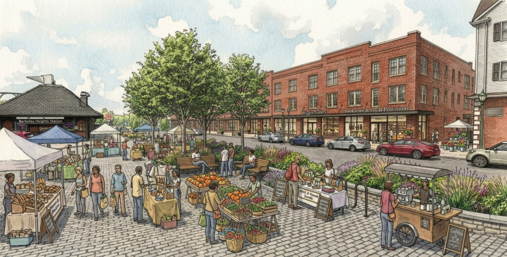
- At the station parking area, the visualization reimagines part of the area as a multi-use plaza with trees, planters, benches, bicycle parking and designated parking and passenger pickup and drop-off areas. The space could accommodate everyday activities as well as farmers’ markets and seasonal events. The station concept builds upon the township’s newly adopted master plan, which calls for a station plaza and gateway node that could serve as a town square.

The strategic plan also provides a roadmap for implementation, organizing potential actions into short, medium, and long-term timeframes, and identifying possible partners and funding sources.
Next steps include testing safety and streetscape improvements using demonstration materials, evaluating parking needs and management strategies, and reviewing zoning to align future development with the community’s vision.
A recording of the presentation is available on the NJTPA YouTube channel.